A trip through the Anykščiai Regional Park by bike

Download

Audio guide

0:00
0:00
Way of traveling: Route distance: 45 km Duration of the route: 8.5 h.
asphalt: 85% dirt road: 10% forest path: 5%

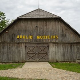
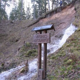
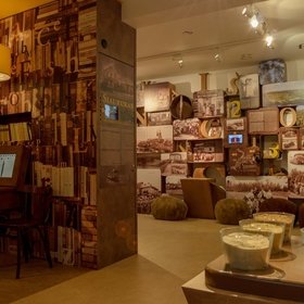
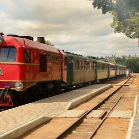
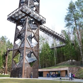
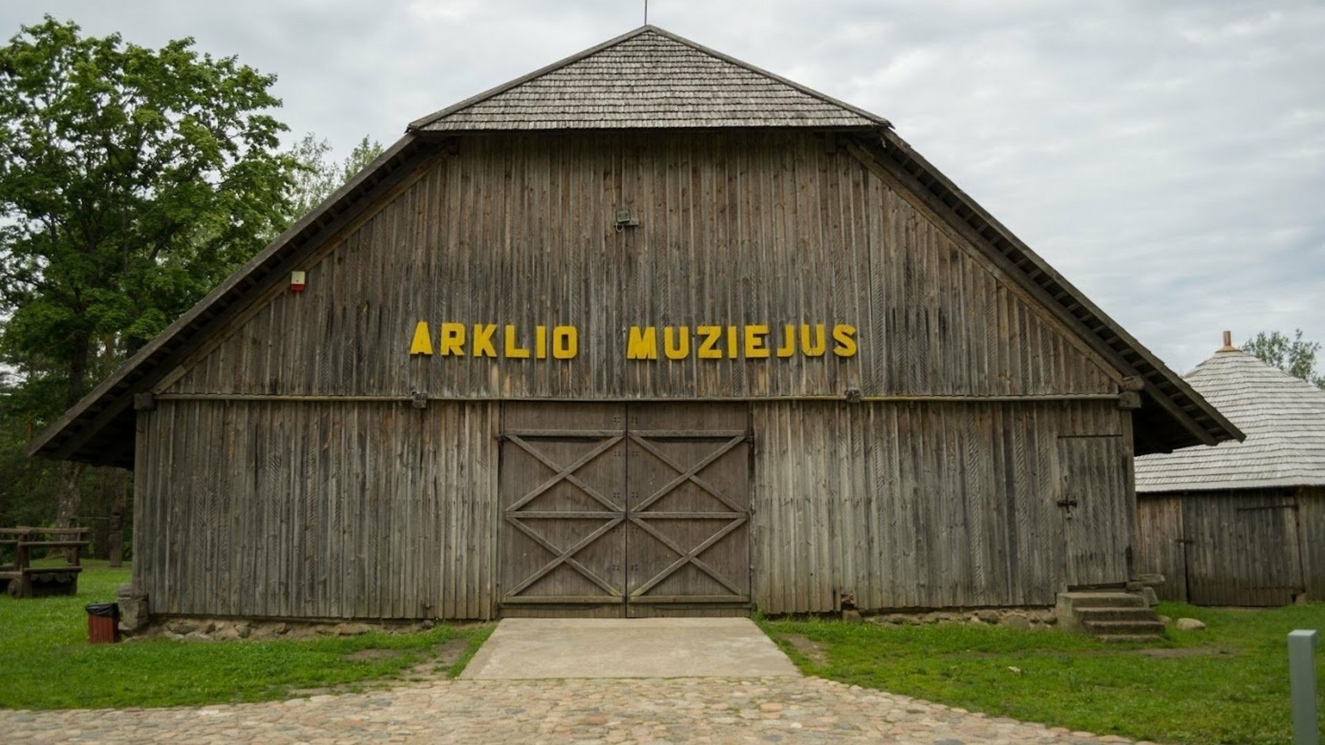
Upon arrival to Anykščiai we suggest exploring the park by bike and choosing the route “A trip around the Anykščiai Regional Park by bike”. From the Visitors’ Center of the Anykščiai Regional Park, we suggest you visit six of the most beautiful attractions of the Park. While cycling on the left bank of the River Šventoji, you will take in the views of Anykščiai and the scenery around the River Šventoji. When you enter the miraculously picturesque forest the Anykščiai Pinewood (Anykščių Šilelis), you will immediately notice the scent of pine and the various bird songs, and as you come across a clearing, you will see the 36-meter-high observation tower of the Treetop Walking Path. Then you can cycle to the ethnographic village of Niūroniai, where the Horse Museum is located. On the way, there you will see the Elme landscape, the Varius hydrographic and botanical reserves. After taking the gravel road that passes Niūroniai village, you will notice a pasture of exceptionally beautiful horses grazing on both sides of the road. If you take this route, the impressions and attractions that await are truly unforgettable.

 
Route start. Horse Museum
There is a Horse museum located 5 km from Anykščiai, Niūronys - a unique attraction in Lithuania. It was founded in 1978 at the initiative of professor of agronomy Petras Vasinauskas, after the professor travelled around Lithuania with žemaitukai and noticed that the horse was no longer involved in daily human life. The entrance of the museum are two threshing barns and the premises of a nearby elementary school, where the first exhibits gathered from all over the Lithuanian territory were placed on display: the chariots, lineika, britzkas, wheels, horses, plows, other tools, harnesses, saddles, horse-drawn flax breaking...
Duration: 1 h.
View
 
Duration: 20 min. Distance: 5 km
Varius outcrop
The Varius river, named after the colour of its copper-coloured water, is a nearly 15m high river bank with steep slopes. The length of the outcrop along the Varius river is approximately 26 meters. The thickest point in the Varius outcrop is characterised by sediments pushed and wrinkled by glaciers. According to the studies of spores and pollen, it may be concluded that the coal-rich quartz sand in the lower part of the outcrop formed during the Miocene (approx. 5 million years ago), and the pollen-free white quartz sand above it formed much later, in the late Pleistocene (approx. 12 thousand years ago) or even during the early...
Duration: 20 min.
View
Duration: 25 min. Distance: 6 km
Visitors’ centre of Anykščiai Regional Park and interactive exhibition
The Directorate and Visitors’ Centre of the Anykščiai Regional Park are located in the territory of the former Anykščiai Manor. The manor house dates back to the 16th-17th century. The building which currently houses the directorate and visitors’ center, is a school built in 1883 (it was renovated in 2010). The classics of the Lithuanian literature Antanas Baranauskas, Jonas Biliūnas and Antanas Vienuolis-Žukauskas studied in this school. The Visitors’ Centre is the gate to the Anykščiai Regional Park. This is the best place to plan your trip and gain the information about the park. The...
Duration: 1 h.
View
 
Duration: < 10 min. Distance: 1.5 km
Anykščiai Church of St. Matthew
The Anykščiai Church of St. Matthew, now entering its second century, has met and seen out several generations of Anykščiai citizens. As a symbol of the city and its most striking panoramic feature, it impresses visitors of the city with its magnificent neo-gothic shapes, its size and its rich history. The construction of the current church lasted from 1899-1909. The neo-gothic red brick church, designed by architect Nikolaj Andrejev, appeared in the centre of the city. The locals themselves contributed to the construction: they burned bricks, carried construction materials, transported iron from Latvia and collected...
Duration: 1 h.
View
Duration: < 10 min. Distance: 1.6 km
Siaurukas
Siaurukas is the way the locals refer to the Aukštaitija Narrow-Gauge Railway that has been delighting visitors and locals for two centuries. It began operation in 1899 - a time of locomotives and wooden wagons. The narrow-gauge railway reached Anykščiai at the end of the last century. The narrow-gauge railroad Pastovys-Švenčionėliai-Utena-Panevėžys was built under the rule of the Tzar and served as a means for transporting timber from massively cut down forests as well as passengers. This was the primary means of transportation even during the postwar era, after the introduction of intercity buses. Citizens of...
Duration: 1 h.
View
Duration: 50 min. Distance: 12 km
The Treetop Walking Path
The Treetop Walking Path is the first of its kind in the Baltics and Eastern Europe and offers its visitors to take a walk along the treetops. The Treetop Walking Path complex is located in the Anykščiai Pinewood, near the famous Puntukas Stone. Many years this place attracted tourists to see the Puntukas Stone, which according to the legend, once was thrown by the devil, when he was in a fit of rage and wanted to destroy the beautiful Anykščiai church. However, the Anykščiai district is also home to other interesting objects like paths for hiking, cycling and water tourism. It is important to note that people with...
Duration: 1 h.
View
 
Duration: 1.5 h. Distance: 18 km